World Mangrove Day puts a number on Indonesia's coastline: 3.46 million hectares and a Rp33 trillion-a-year question
By Sirkularium Editorial Team, 8 min read
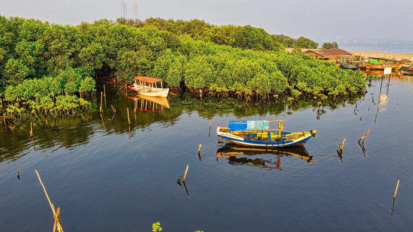
Indonesia marked World Mangrove Day on 26 July 2026 with a national planting drive led by the Ministry of Environment and state miner ANTAM, against a backdrop of a newly confirmed 3.46 million hectare mangrove estate and blue carbon potential estimated at up to Rp33 trillion a year. The day also intersects with a quieter but consequential shift: GIS-based AMDAL rules aimed squarely at mining's coastal footprint.
A planting day with a number attached
On Sunday, 26 July 2026, Indonesia's Ministry of Environment and Environmental Control Agency (KLH/BPLH) coordinated simultaneous mangrove planting across the country to mark World Mangrove Day, the UNESCO-designated observance held every year on 26 July. This year's commemoration, centred in Bali at 07:00 WITA, carried the theme "Menjaga Mangrove, Mengamankan Generasi Mendatang" (Protecting Mangrove, Securing the Next Generation), formalised through a ministerial circular, Surat Edaran No. 10/2026, inviting provincial governments, businesses, civil society, media, and communities to take part.
In Jakarta, the day's most visible event paired the ministry with state mining company PT Aneka Tambang Tbk (ANTAM), which planted 5,000 mangrove seedlings in the SCBD Sudirman area as the opening act of its "Gerak Hijau 2026" programme, timed to the company's 58th anniversary. ANTAM Director Untung Budiharto framed the planting in ecosystem terms rather than as a one-off gesture: protecting mangrove, he said, means protecting coastal areas, safeguarding biodiversity, and strengthening carbon absorption. Deputy Minister of Environment and Forestry Diaz Faisal Malik Hendropriyono, representing the ministry at the event, described mangrove's benefits as running "hingga puluhan bahkan ratusan tahun mendatang", decades to centuries ahead, and called for a three-way collaboration between government policy, responsible business practice, and everyday community habits.
State bank BNI marked the same day by highlighting a longer-running effort: 258,000 mangrove seedlings planted over eight years under its Tanggung Jawab Sosial dan Lingkungan (TJSL) BNI Berbagi programme, across five coastal locations, Mempawah in West Kalimantan, Kebumen in Central Java, the Thousand Islands off Jakarta, Banyuwangi in East Java, and Pamekasan in East Java. Corporate Secretary Okki Rushartomo said the programme deliberately links restoration to livelihoods, engaging coastal farmers from the seedling stage through to processed mangrove products and ecotourism. An internal evaluation of the Banyuwangi component recorded an 84.09 percent community satisfaction index, a rare piece of outcome data in a field more often reported by seedling counts than by results.
The numbers behind the day
The commemoration landed against an already-updated national baseline. On 23 December 2025, the Minister of Environment/Head of BPLH signed Decree SK 3438, setting the National Mangrove Map 2025 at 3,455,628 hectares across 37 provinces, an increase of 15,164 hectares over the 2024 figure of 3,440,464 hectares, according to Puji Iswari, the ministry's Director of Land Ecosystem Protection and Management. That continues a slow upward trend visible in the ministry's own historical figures: roughly 3.36 million hectares in 2021, 3.39 million hectares in 2022, and the 3.44 million and 3.46 million hectare readings that followed. Indonesia's mangrove estate remains, by a wide margin, the largest in the world, representing around a fifth of the global total, concentrated most heavily in South Papua (622,288 hectares), West Papua (326,666 hectares), Central Papua (305,846 hectares), East Kalimantan (239,805 hectares), and Riau (230,911 hectares).
Layered on top of the area figures is a national economic estimate that has begun circulating more widely this year. Asep Hidayat, Head of the Ecology Research Center at Indonesia's National Research and Innovation Agency (BRIN), has put the country's blue carbon economic potential, spanning mangrove and seagrass ecosystems, at Rp16 trillion to Rp33 trillion a year, equivalent to roughly USD 1 billion to USD 2 billion, based on mangrove sequestration rates of 800 to 1,200 tons of CO2 per hectare and indicative carbon prices of USD 5 to USD 20 per ton. Indonesia additionally holds around 600,000 hectares of Indo-Pacific seagrass meadows and an estimated 17 percent of the world's coastal blue carbon reserves. Hidayat described the opportunity plainly: this is potential the country can optimise and turn into a new source of business, rather than treat purely as a conservation cost.
"We already know if the project will impact mangrove or cause sedimentation," said Sigit Reliantoro, the Ministry of Environment's Deputy for Environmental Management and Sustainable Natural Resources, describing how GIS-based spatial mapping is replacing narrative-only AMDAL documents for projects near mangrove coastline.
Where mining enters the picture
Five days before World Mangrove Day, on 21 July 2026, the same ministry disclosed a more targeted policy shift with direct relevance to Sirkularium's mining-sector audience: it is strengthening AMDAL, the Analisis Mengenai Dampak Lingkungan environmental impact assessment, with Geographic Information System overlays specifically to catch nickel mining's potential effects on mangrove ecosystems before permits are issued, rather than after damage is reported. Reliantoro's point was that spatial mapping lets regulators see, at the planning stage, whether a proposed concession will intersect mangrove cover or generate downstream sedimentation, a determination that narrative AMDAL documents have historically struggled to make with precision.
The policy also introduces a "zero hydrology" requirement: water discharge from a mining site must remain equivalent before and after operations begin, enforced through sediment ponds and rainwater harvesting for operational recycling. A further stated aim is to consolidate fragmented small-scale mining activity that has proven harder to monitor than larger, permitted operations. Reliantoro noted the GIS system is technically operational but awaits a formal public launch pending budget allocation, meaning the mechanism is real but its full rollout timeline is not yet fixed.
This is the connective tissue between a planting ceremony and a compliance regime. Indonesia's mangrove coastline sits disproportionately close to nickel-producing regions in Maluku, Sulawesi, and parts of Kalimantan, the same geography covered by GIS-based AMDAL screening. A hectare of mangrove that regulators can now flag before a permit is issued is also, per BRIN's estimate, a hectare carrying real, if still provisional, carbon and ecosystem-service value, on the order of tens of thousands of US dollars over its productive life when carbon, fisheries, and coastal protection functions are combined. Bringing those two figures, area under GIS screening and estimated value per hectare, into the same conversation is precisely the kind of calculation Sirkularium's economic valuation practice is built to perform for operators and for government.
Why it matters for compliance and financing
For mining companies, the shift toward GIS-based AMDAL should be read as an opportunity rather than only a new compliance burden. A spatial baseline that shows, before construction, where mangrove and hydrology risk sits also gives an operator the evidentiary foundation to demonstrate, later, that a concession was sited and managed responsibly. Under Permen LH No. 7 Tahun 2014, Indonesia already has a standing methodology for pricing ecological damage, environmental economic loss, and recovery cost; the same logic applies in reverse to environmental benefit and avoided damage. Companies that commission independent, GIS-plus-ground-truthed valuation ahead of an AMDAL review, rather than in response to a dispute, are better positioned to defend their environmental record to KLHK and to prospective financiers increasingly attentive to blue carbon and nature-related disclosure.
For government and public institutions, the more interesting number in this story may not be the seedling counts but the trillion-rupiah range attached to blue carbon nationally. That figure remains an estimate, not a market price, and Hidayat's own caveats, on measurement standards, additionality, leakage, unclear coastal tenure, fragmented cross-sector policy, and high monitoring and verification costs, are a fair description of why Indonesia has mangrove maps updated annually but no functioning blue carbon market yet. The Ministry of Maritime Affairs and Fisheries has targeted 2027 for blue carbon trading to begin. That gives roughly eighteen months for the standards, tenure clarity, and measurement infrastructure, GIS-based AMDAL among them, to mature enough that the Rp16-33 trillion figure can move from potential to realised revenue.
Sirkularium's view
The lesson of World Mangrove Day 2026 is less about the specific seedling totals than about the direction of travel: mangrove ecosystems are steadily becoming a line item, not a footnote, in how Indonesia assesses mining and coastal development. A national map updated on a fixed annual cycle, a GIS layer built into AMDAL review, and a credible, if still developing, blue carbon valuation range together form the beginnings of a routine measurement infrastructure rather than a series of one-off gestures. Sirkularium's recommendation to mining operators and to the government agencies that oversee them is to treat this infrastructure as an ongoing practice rather than a response to any single incident: commission rigorous, independently verified economic valuation, combining GIS mapping with ground data and Indonesia's existing environmental economic loss methodology, on a standing basis. Done consistently, that valuation becomes the evidence base operators need to satisfy KLHK, the input government needs to price blue carbon credibly once trading begins in 2027, and the shared reference point that lets a mining concession and a mangrove hectare be discussed in the same, constructive conversation.
Indonesia's national mangrove area, by map year
Values in million hectares
Sources
- Kompas (money.kompas.com), Peringati Hari Mangrove Sedunia, Penanaman 5.000 Bibit Jadi Awal Gerak Hijau ANTAM
- ANTARA News, Peringati Hari Mangrove, KLH dan ANTAM menanam 5.000 bibit mangrove
- Kementerian Lingkungan Hidup, Peringatan Hari Mangrove Sedunia Tahun 2026
- ANTARA News, Hari Mangrove Sedunia jadi momentum BNI perkuat komitmen pelestarian lingkungan dan ekonomi pesisir
- Media Nikel Indonesia, KLH Perkuat Amdal Berbasis GIS untuk Cegah Dampak Tambang Nikel terhadap Ekosistem Bakau
- ANTARA News, Pemerintah tetapkan Peta Mangrove Nasional 2025 seluas 3,45 juta ha
- Kompas Lestari, Potensi Karbon Biru Indonesia Capai Rp 33 Triliun per Tahun, Apa Tantangannya?